
Page Contents
What Are Clouds?
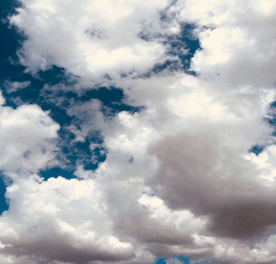
Clouds in meteorology is made of water drops or ice crystals floating in the sky. There are many kinds of clouds. Clouds are the prominent features in the sky and of continual interest to meteorologists because they provide a visual indication of atmospheric conditions.
How Do Clouds Form?
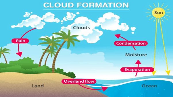
Clouds in meteorology form when water vapour condenses in the atmosphere due to adiabatic cooling. Air rises and passes through regions of lower pressure. As a result, rising air expands and cools adiabatically.
When the ascending air parcel has cooled to its dew-point temperature, condensation starts to occur. In order for condensation to occur, two conditions must be met:
1.The air must be saturated
2.there must be a surface on which the water vapour can condense.
When condensation occurs aloft, tiny particles known as cloud condensation nuclei serve as the surface for condensation. Cloud condensation nuclei can be microscopic dust, smoke, and salt particles.
Cloud classification
Clouds in meteorology can be classified in two ways.
One way is by where they are found in the sky.
1.Some clouds are high up in the sky.
2.Low clouds form closer to Earth’s surface.
3.Middle clouds are found between low and high clouds.
Another way clouds are named is by their shape. Cirrus clouds are high clouds. They look like feathers. Cumulus clouds are middle clouds. These clouds look like giant cotton balls in the sky. Stratus clouds are low clouds. They cover the sky like bed sheets. Further, some clouds extend upward to span more than one height range and are called clouds of vertical development.
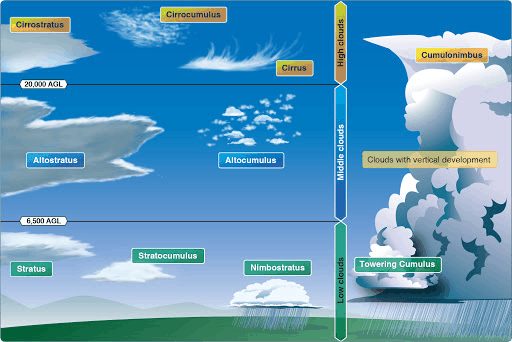
The three main types of Clouds in meteorology
- High-level clouds (5-13 km): cirrocumulus, cirrus, and cirrostratus.
- Mid-level clouds (2-7 km): altocumulus, altostratus, and nimbostratus.
- Low-level clouds (0-2 km): stratus, cumulus, cumulonimbus, and stratocumulus.
High clouds
The family of high clouds include cirrus, cirrostratus, and cirrocumulus. Low temperatures and small quantities of water vapour present at high altitudes result in high clouds that are thin, white, and made up primarily of ice crystals.
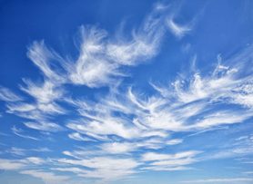
Cirrus clouds: Cirrus clouds are short, detached, hair-like clouds found at high altitudes. These delicate clouds are wispy, with a silky sheen, or look like tufts of hair. Cirrus clouds are the most common of the high clouds and have filament appearance.
Cirrostratus clouds: Cirrostratus (Cs) – the name is a composite of the Latin cirrus = wisp or curl and stratus = layer. Cirrostratus are sheet-like, high-level clouds composed of ice crystals. Though cirrostratus can cover the entire sky and be up to several thousand feet thick, they are relatively transparent, as the sun or the moon can easily be seen through them. It is made out of ice-crystals, which are pieces of frozen water.
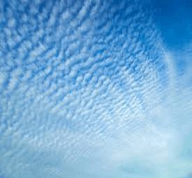
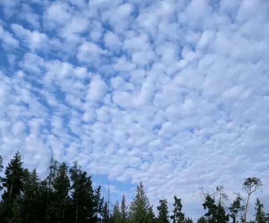
Cirrocumulus clouds: Cirrocumulus is one of the three main types of high-altitude tropospheric clouds. They usually occur at an altitude of 5 kilometres to 12 kilometres. Like lower altitude cumuliform and stratocumuliform clouds, cirrocumulus signifies convection. They are small rounded puffs that usually appear in long rows high in the sky. They are usually white, but sometimes appear grey.
Middle clouds
Clouds that form in the middle altitude range 2000–6000 meters are described with the prefix alto (meaning “middle”) and include two types: altocumulus and altostratus.
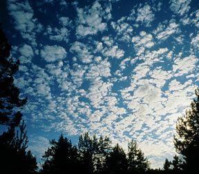
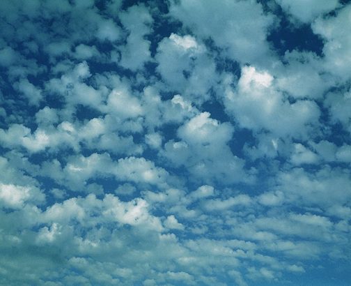
Altocumulus clouds: Altocumulus is a middle-altitude cloud genus that belongs mainly to the stratocumuliform physical category characterized by globular masses or rolls in layers or patches. They are mid-level clouds that are made of water droplets and appear as grey puffy masses. They usually form in groups. If you see altocumulusclouds on a warm, sticky morning, be prepared to see thunderstorms late in the afternoon.
Altostratus clouds: Altostratus is a middle altitude cloud genus belonging to the strati form physical category characterized by a generally uniform grey to bluish-green sheet or layer. It is lighter in colour than nimbostratus and darker than high cirrostratus.
Low clouds
There are three members of the family of low clouds below 2000 meters: stratus, stratocumulus, and
nimbostratus. Stratus clouds are uniform and flat, producing a grey layer of cloud cover which may be precipitation-free or may cause periods of light precipitation or drizzle.
a) Stratus clouds: Stratusis a uniform layer that frequently covers much of the sky and, on occasion, may produce light precipitation.
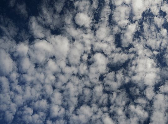
b)Stratocumulus clouds: A stratocumulus cloud, occasionally called a cumulostratus, belongs to a genus-type of clouds characterized by large dark, rounded masses, usually in groups, lines, or waves, the individual elements being larger than those in altocumulus, and the whole being at a lower height, usually below 2,000 metres. Stratocumulus clouds are low, puffy and grey in colour. They tend to form in lumpy rows.
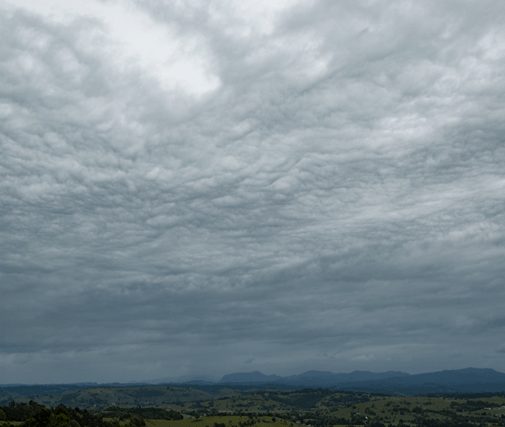
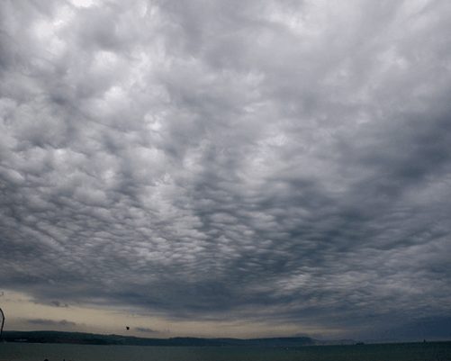
Nimbostratus clouds: Nimbostratus clouds are one of the chief precipitation producers. A nimbostratuscloud is a multi-level, grey, often dark, amorphous, nearly uniform cloud that usually produces continuous rain, snow, or sleet but no lightning or thunder.
Clouds of vertical development
Clouds that do not fit into any of the three height categories but instead have their bases in the low height range and extend upward into the middle or high altitudes are referred to as clouds of vertical development. The most familiar type, cumulusclouds, are individual masses that develop into vertical domes or towers having tops that resemble a head of cauliflower. Cumulus clouds most often form on clear days when unequal surface heating causes parcels of air to rise convectively above the lifting condensation level.

If the cloud continues to grow and rain begins to fall, it is called a cumulonimbus.
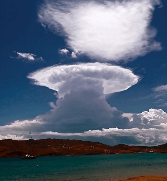
Cumulonimbus clouds are a type of cumulus cloud associated with thunder storms and heavy precipitation. They are also a variation of nimbus or precipitation bearing clouds. They are formed beneath 20,000 ft. and are relatively close to the ground. This is why they have so much moisture.
See also Meteorology